Satellite images and geophysics acquisition: high-potential, high-resolution images
Satellite observation of the Earth is a tool that enables:
● Analysis (mapping, detecting changes, etc.)
● Inventory creation (e.g. of land use)
● Assistance with forecasting (e.g. for farming), or
● Simulation (of natural risks, etc.).
Today, a large proportion of satellite images can be accessed free of charge.
To complement this, we propose data acquisition by drone or light aircraft enabling the areas of interest to be analysed at different resolutions.

Technical and discipline knowledge to achieve optimal processing
In remote sensing, knowledge about sensors and processing techniques is crucial, as is discipline-specific knowledge, in order to put all the data into an applications context.
Platforms that allow satellite image access and processing online enable users to access images directly and process data in the Cloud, with performances far superior to the standard methods. Thanks to the interactive nature of these technologies, we are rolling out powerful tools and continuously maintaining the applications.
To meet a client’s requirements, we look for the data source that best suits the topic in question, and the processing space that will be most effective and deliver maximum value.
Artificial intelligence to enhance processing of these mass data
Now that thousands of databases and image repositories have been made available, and processing techniques have evolved, the use of artificial intelligence to refine this information has become a major stake.
● Image queries and information aggregation: to boost speed and efficiency thanks to machine learning.
● Techniques for detecting and observing changes: to reproduce a human interpretation, but with enhanced sensitivity via algorithms.
Contextualising and distributing high-added-value information
After processing, contextualisation of the data is essential in order to utilise the full potential of the satellite images. CVA propose GIS solutions that can be made available quickly and simply, and enable cross-processing with other information sources.
● Development and evolution of GIS (Geographic Information System)
● Installation and development of GIS infrastructure: web server, mapping server, distribution interfaces (the French government’s IGN Geoportal, Google Earth and Google Earth Engine, or a web portal solution devised in-house by CVA)
● Development of dedicated applications and tools for handling a wide range of data formats.
Contacts

Carine Rouillon
Holder of a Geological Engineering diploma from France’s UniLaSalle (Beauvais campus), Carine has 15 years of industrial experience in Geoscience projects and data management, notably as manager of an engineering department.

Stéphane Dennebouy
Trained in Physics and Chemistry, followed by a PhD in Geosciences from Mines ParisTech (the Paris School of Mines), Stéphane entered the industry as a Data Scientist. He has almost 20 years of experience as a Project Manager and Business Engineer.
Since 2012, Carine and Stéphane have run the technical assistance and project support activities in the fields of Geosciences, Biosciences, Big Data and IT.
Plus points

OPTIMISED COSTS
Thanks to the large volume of images available free of charge, and in-house or open-source solutions, we offer cost-controlled solutions.

CROSSED EXPERTISE
With our combination of discipline expertise and technical expertise – data, processing and IT – we are well placed to provide an optimum service.

INNOVATION
Processing speed and efficiency are boosted by the addition of artificial intelligence.
DISCOVER
Example
cases

A crucial information source for Geosciences and Biosciences
“Thanks to the spatial and spectral resolutions of the latest satellites, it is becoming possible to distinguish more accurately between target objects, which opens new possibilities for environmental and land management themes in the years ahead.”
Leo T., Geomatics Expert
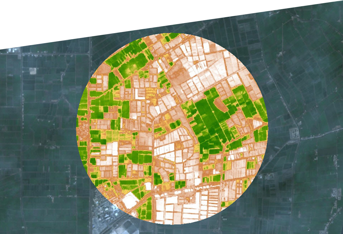
Image from Sentinel 2, using NDVI (Normalized Difference Vegetation Index) processing, focusing on the Nile Delta. The green corresponds to the areas with the highest levels of live green vegetation cover.
Satellite images play a major role in helping scientists understand the geological structure of a study area and how its land surface is used (infrastructure, vegetation, hydrographic networks, etc.). Images captured at regular time intervals provide the means to monitor the land surface, focusing on different themes (hazards, agriculture, environment).
Application examples
● Characterising types of geological facies
● Creating structural maps based on radar images
● Monitoring landslides
● Monitoring hydrogeological conditions
● Monitoring vegetation.

A watchful eye on vegetation: monitoring forests
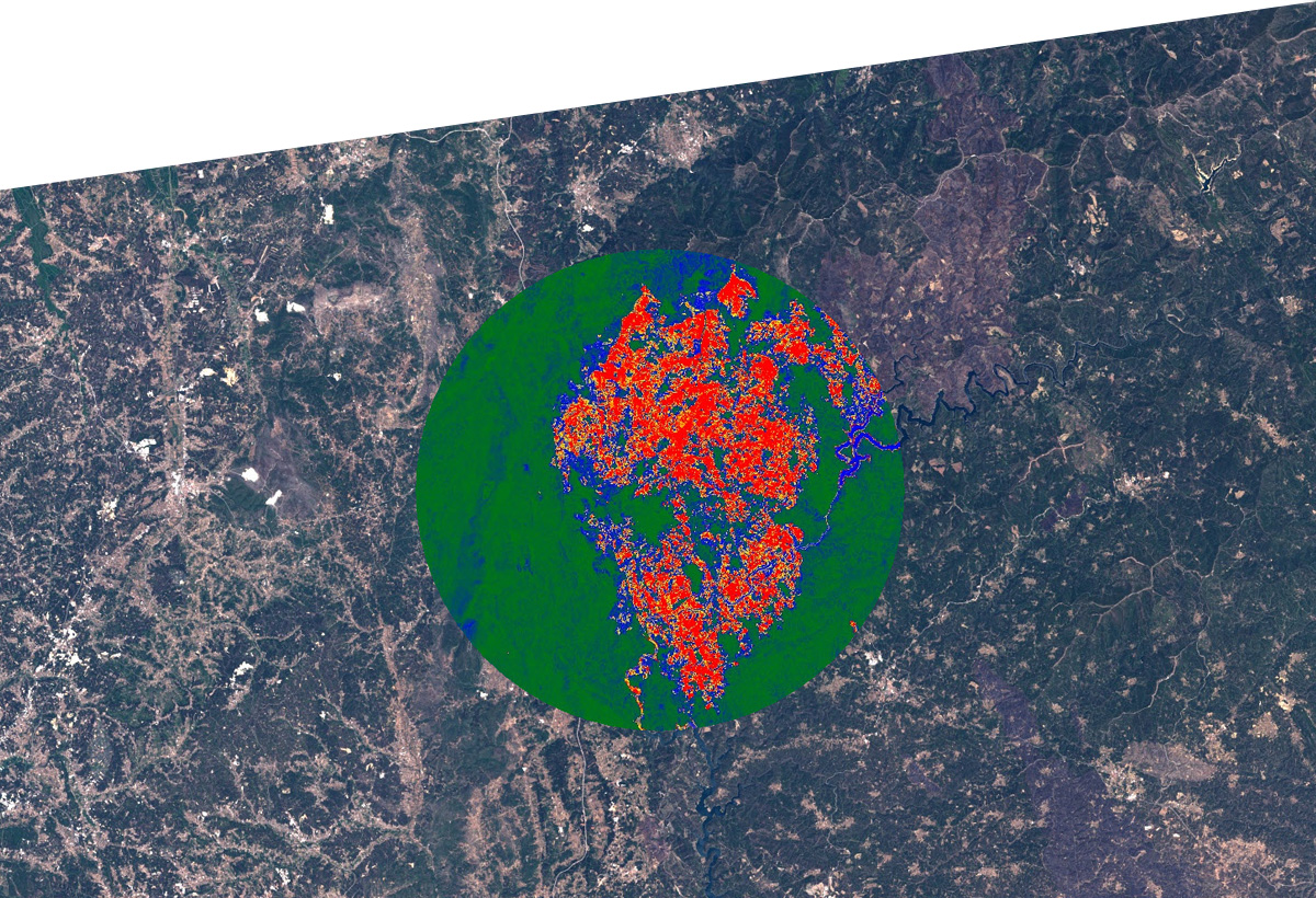
Landsat 8 image in natural colour, and BAI (Burned Area Index) processing showing the forest fires of 2 July 2017 in Portugal. Red indicates the fire-affected areas.
Monitoring forested areas, a vital stake in the fight against climate imbalance, has been a familiar theme in remote sensing for some years.
Thanks to the multitude of satellites currently in operation, there are many opportunities to revisit locations, minimising the risk of an event going undetected.
With different multi-spectral indices and image redundancy, it is possible to monitor changes in vegetation over several years and introduce good management strategies.

Urban area: changes in infrastructure (high resolution)
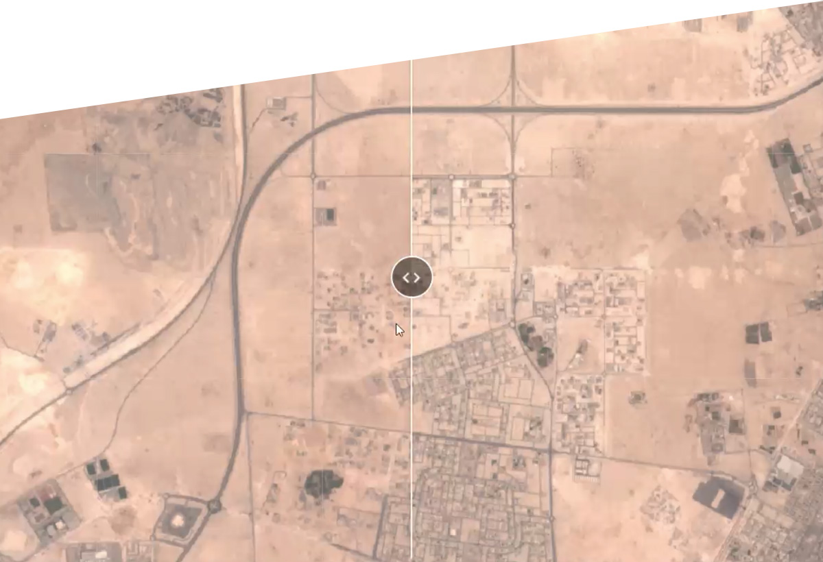
Detection can create a visual record of surface changes, in the differences between two images taken on different dates.
A time series can be used to show land surface changes resulting from seasonal activity or visible over a long period.
